- MSSEP | Students present eelgrass and water quality research at Big Blue Conference

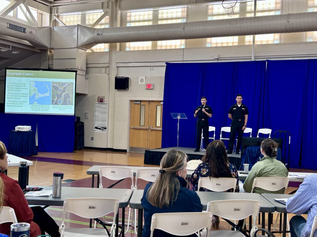
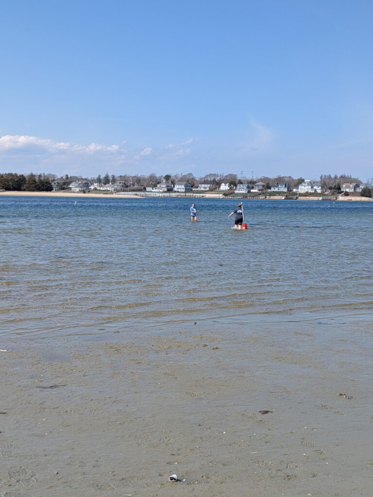
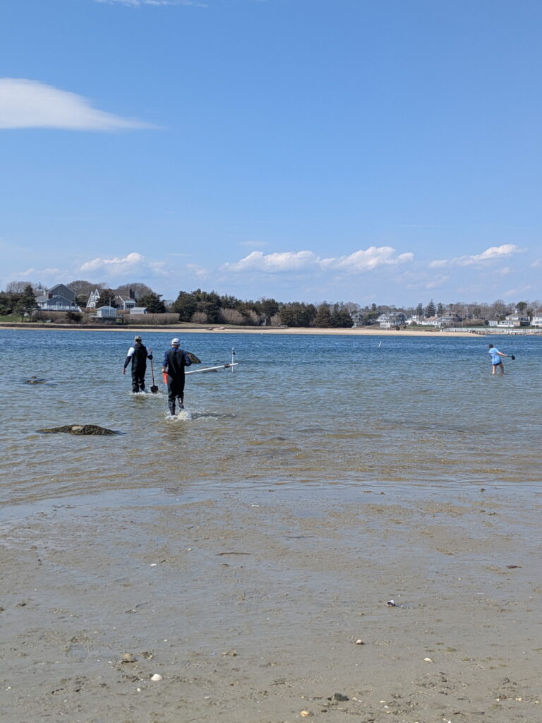
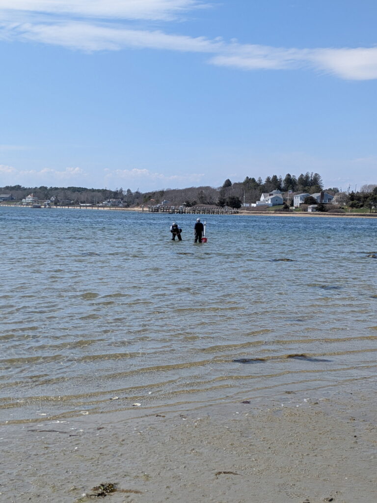
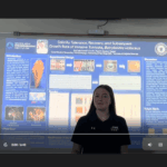
On April 28, MSSEP students Daniel Kowalski and William Eltringham presented their research on eelgrass and water quality in Buzzards Bay at the Big Blue Conference at Falmouth High School.
Daniel and William conducted this research in Professor Kevin Hefferan’s Environmental Monitoring course, a senior capstone MSSEP course, which requires field work, data collection, and data analysis. Each week, these students take our small research vessel into the Bay to evaluate eelgrass coverage, nutrient concentrations, dissolved oxygen concentrations, and light availability, which are all critical water quality variables.
This research is designed to ground truth aerial surveys conducted by Mass DEP for eelgrass coverage from 2019-2023. Several years later, students are finding that areas previously mapped with eelgrass coverage are now barren or outcompeted by invasive seaweeds.
Furthermore, we have teamed up with NOAA and the eMOLT program to capture dissolved oxygen concentrations at two sites using the NOAA supplied sensors. George Maynard (NOAA) is our collaborator.
This research will continue with next year’s seniors, as it is valuable to understand the health of the Bay, particular to eelgrass ecosystems. All of this ties into the Blue Economy initiative of Mass Maritime.
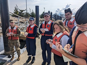
- MSSEP | Bird Deterrent Project
MSSEP students are doing bird deterrent research to reduce bird activity around an oyster farm on campus at Cadet Beach.
- MSSEP | MSSEP Graduates Lead the Way in Innovative Marine Science Research
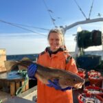
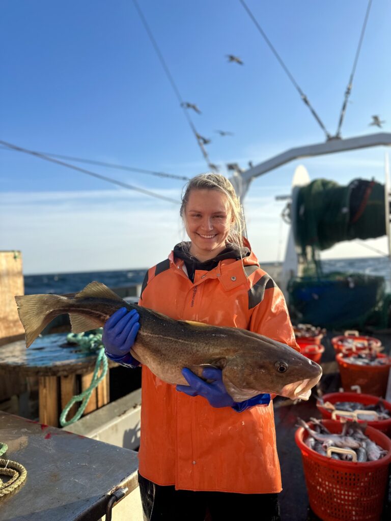
MSSEP students continue to make waves in marine research. MSSEP graduate Helena Norton (MSSEP ’22) is currently a Master’s student at UMass Dartmouth, working alongside research faculty on innovative projects, such as video trawl surveying. This research uses underwater cameras within trawl nets to observe, count, and measure fish in their natural habitats, eliminating the need for capture.
Helena’s Master’s research focuses on the demographics of spiny dogfish on Georges Bank and in the Gulf of Maine, exploring how environmental and biological factors shape their distribution and population dynamics. Helena recently published articles in American Fisheries Society and Reviews in Fisheries Science & Aquaculture. Through hands-on research, MSSEP students gain valuable experience and contribute to advancing marine science.
- MSSEP | Student Success in Research

Since 2024, several MSSEP students have volunteered as scientists aboard NOAA’s Ecosystem Monitoring (EcoMon) cruises on the Henry B. Bigelow. EcoMon surveys are carried out at 120 randomly chosen stations and 35 fixed stations throughout the continental shelf and slope of the northeastern United States. At each station, MSSEP students collected and preserved plankton, larval fish, and eggs captured by bongo nets. These samples were used to calculate estimates of overall fish biodiversity and spawning stock biomass. Students also measured and preserved chlorophyll and nutrients captured at different depths using a CTD Rosette. To hear more about exciting student-based research opportunities in MSSEP, please reach out to Department Chair Heather Burton (hburton@maritime.edu).
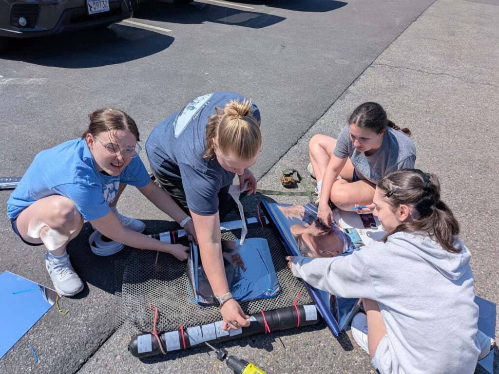
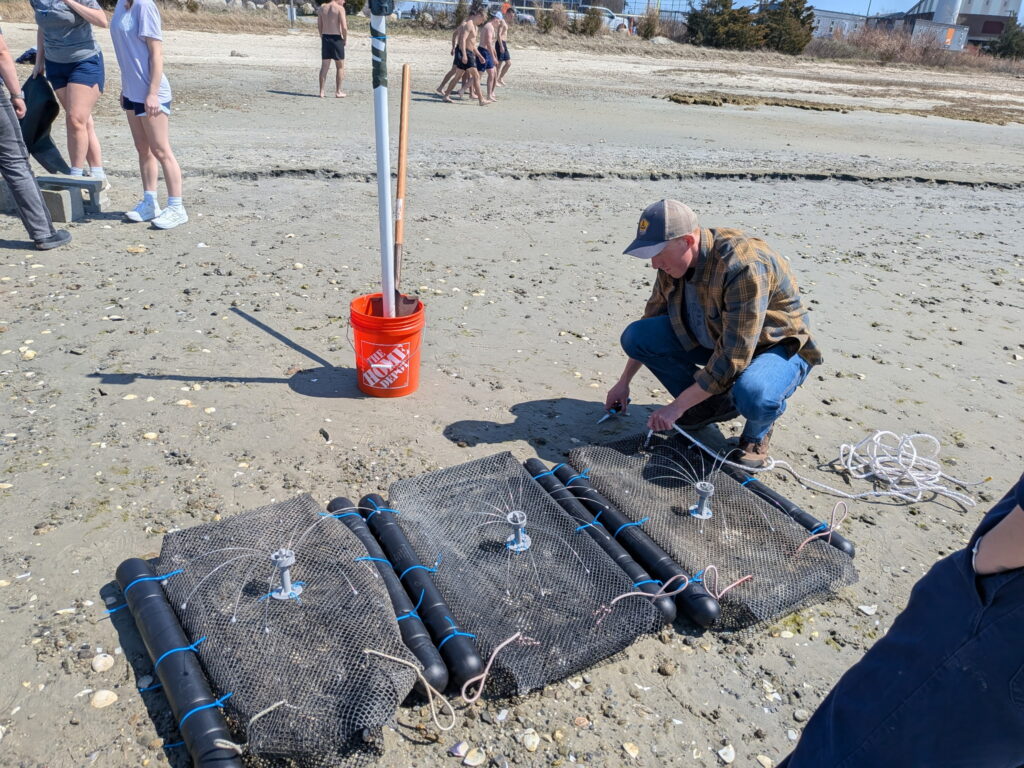
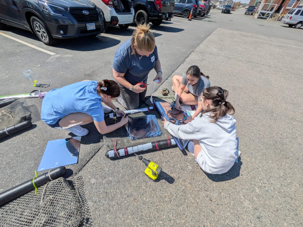
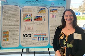
- MSSEP | 2025 Eelgrass Mapping Student Research
Environmental Monitoring is a senior capstone class for MSSEP students that provides an invaluable opportunity for hands-on fieldwork and research in various environmental projects. The range of activities, from fish tagging to bird sightings to microplastic counting on beaches, offers students a diverse and comprehensive understanding of environmental monitoring techniques. Students not only learn how to conduct research effectively but also develop essential skills in data collection, analysis, and interpretation. By actively participating in environmental monitoring projects, students contribute to the ongoing efforts in environmental conservation and management.
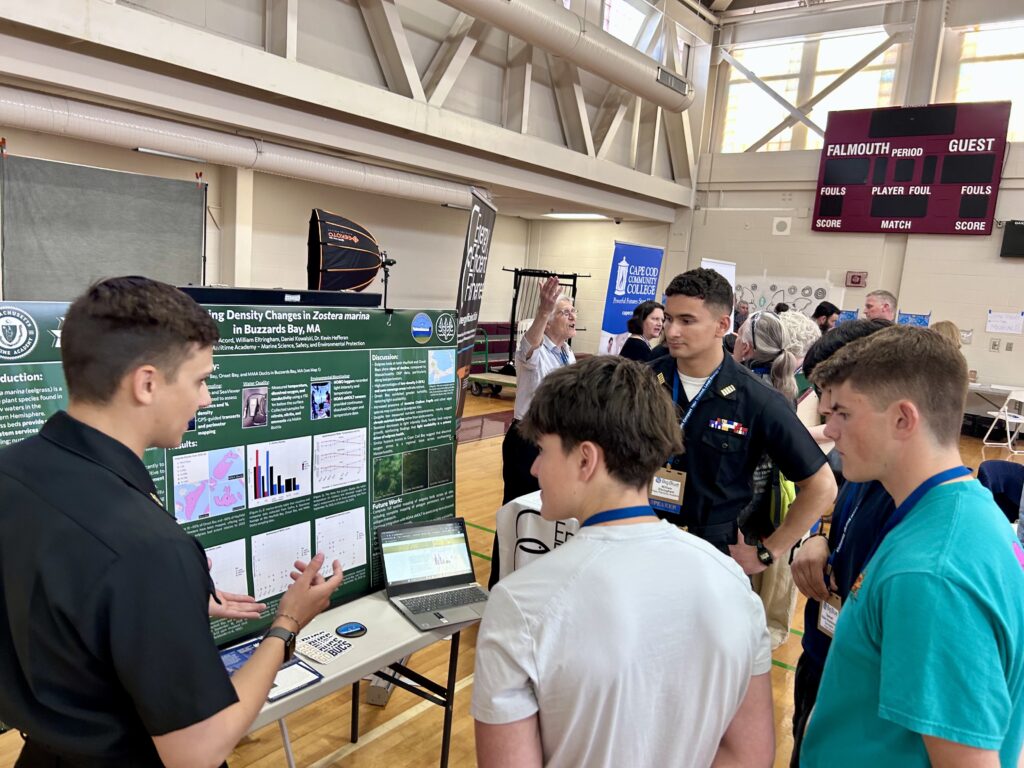
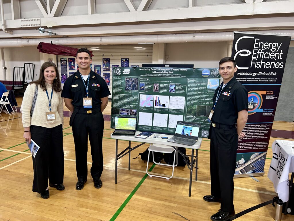
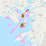
One exciting project focuses on monitoring Zostera marina, more commonly known as eelgrass. Throughout the fall and spring semesters, students embarked on weekly research trips on Buzzards Bay aboard the Zostera center console research vessel, deploying an underwater camera to track eelgrass density in Onset Bay, Hayfield Bay, and adjacent to the Academy docks. Eelgrass serves as a reliable indicator of water quality, thriving in areas with sufficient light penetration and balanced nutrient levels. Using GIS software, the group documented latitude and longitude coordinates and analyzed nitrogenous compound concentrations in the water to assess the impact of eutrophication on this species.
The group also contributed their data to a publicly accessible ArcGIS Online map that was created by the 2023-24 MSSEP eelgrass monitoring group. The 2023-24 MSSEP group collated data collected by previous MSSEP student groups over the past four years and compiled these data gen77 into an ArcGIS Online map for comparison of eelgrass changes over time. Additionally, Massachusetts Department of Environmental Protection satellite imagery of eelgrass beds from 1995 to 2023 were overlaid onto the map to provide a representation of visual changes in density over the years. This integration of data into GIS significantly enhances its accessibility and utility for the scientific community. The team’s aspiration is for future groups to continue this study, adding their data to the ArcGIS map, thereby enriching the dataset over time and providing a more robust analysis of eelgrass beds in Buzzards Bay.
- MSSEP | June 10, 2025: McCaela Accord’s Independent Study work on Tunicates (video)
- MSSEP | January 2025 MSSEP Geological Oceanography Hawaii Trip
Check out the Geological Oceanography Hawaii Trip Storymap!
- MSSEP News Archives

January 2025 Geological Oceanography Hawaii Field Trip
2025 Hawaii Field Experience Story Map
Cadets Jessica Rotondo and Lucas Pender were recently volunteer scientists aboard NOAA’s Spring Ecosystem Monitoring (EcoMon) cruise on the Henry B. Bigelow. EcoMon surveys are carried out at 120 randomly chosen stations and 35 fixed stations throughout the continental shelf and slope of the northeastern United States, from Cape Hatteras, North Carolina, to Cape Sable, Nova Scotia, and encompassing the entirety of Georges Bank and the Gulf of Maine. Jessica and Lucas were on opposite 12-hour shifts. Their responsibilities at each station included washing down bongo nets and preserving the plankton, larval fish, and eggs, which were used to calculate estimates of overall fish biodiversity and spawning stock biomass. They also measured and preserved chlorophyll and nutrients captured at different depths using a CTD Rosette.
Please see video to the right!
3 June 2024: Grace Jensen (MSSEP ‘2021, Summa Cum Laude) recently passed her Master’s Thesis defense “A Census of Cyclonic Eddies South of the Gulf Stream and an Analysis of their Formation Types” at UMass Dartmouth. Grace will continue on to a PhD program with the Massachusetts Institute of Technology (MIT) – Woods Hole Oceanographic Institution (WHOI) Joint Program to conduct physical oceanography research.
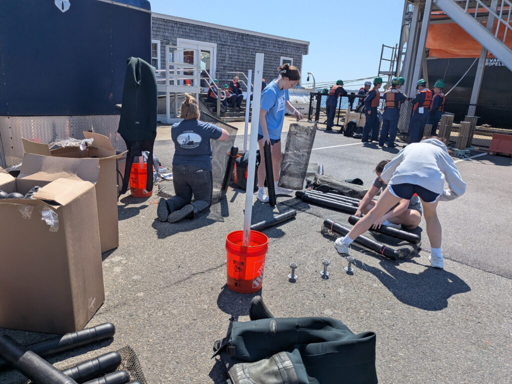
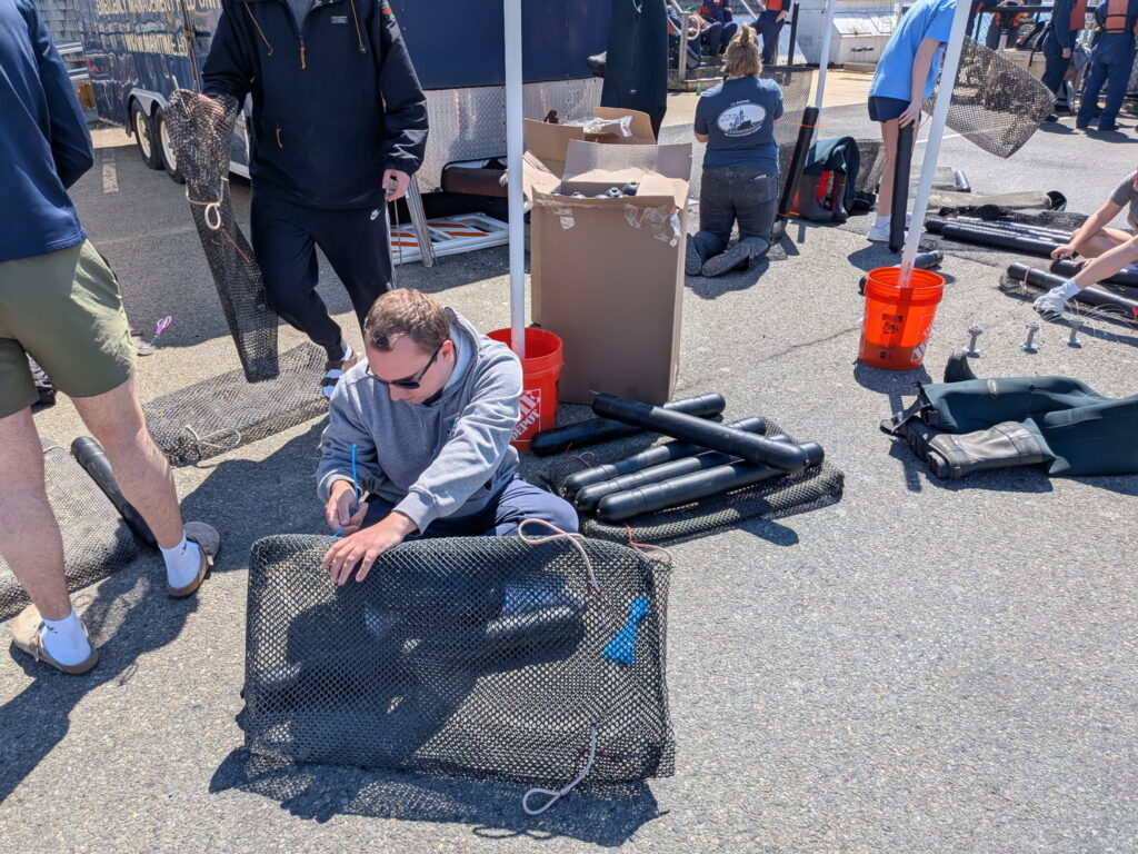
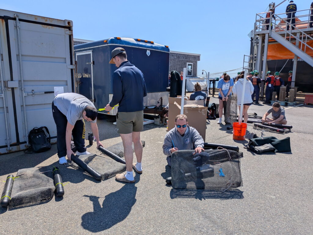
27 September 2023: Marine Invertebrate Zoology students are preparing for the Benthic Underwater Community Survey (BUCS) project “cube” deployment to monitor for marine invasive species at Massachusetts Maritime Academy. Organisms will grow on plexiglass surfaces called settlement plates that are attached to the PVC cube frame. These settlement plates allow students to observe weekly changes in relative species abundance over the course of the semester. This project is intended to add quantitative value to the Massachusetts Office of Coastal Zone Management’s citizen-science Marine Invader Monitoring and Information Collaborative (MIMIC) program, which MSSEP has participated in for several years.
10 August 2023: Alongside Dr. Kristin Osborne, MSSEP students Jessica Rotondo and Aidan Webb participated in the MA Coastal Zone Management rapid assessment survey for marine invasive species. They traveled along the northeast coast sampling for invaders at marinas. A group of 30 scientists from around the country came to Mass Maritime to process the marine samples.
For more on this program visit https://www.mass.gov/service-details/rapid-assessment-surveys-of-marine-invasive-species
3 August 2023: On August 1, a delegation from the U.S. Environmental Protection Agency (EPA) came to the Wareham Middle School to view the stormwater investigative work being conducted by the Buzzards Bay Stormwater Collaborative. The Buzzards Bay Stormwater Collaborative is a partnership between the Buzzards Bay NEP, Massachusetts Maritime Academy, and eight Buzzards Bay towns (Bourne, Wareham, Marion, Mattapoisett, Acushnet, Fairhaven, Dartmouth, and Westport). The Stormwater Collaborative is an excellent example of how NEPs can promote efficient partnerships to meet our collective goals to protect and restore water quality and living resources. The EPA delegation was most impressed with the work of the Maritime students and how this program helps advance the completion of their degrees.
Read the full article:
EPA site visit to Stormwater Collaborative Investigations in Wareham
